
|
|
||
|
|
|
There and back again Tools and more info The Importance of Practicing MOB Drills and Crew Training Misc Top 10 Online Boating Resources |
|
||
The First Rule of BoatingKnow where you areIf the first rule of boating is “Stay on the boat”, then the first rule of seamanship has to be “Know where you are”.
“No”, you say, you always know where you are and where you are going. “Where is your chart?” I ask. “Are you sure about what lies ahead?” An ‘experienced’ sailor we know took off one day in a brand new boat. He saw a white buoy off to one side and decided to check out what it said on it. Chart – no, he had been buzzing around the area in his whaler for years. So, over to the white cylindrical marker he motored on his first outing at full throttle, proud of his pretty craft – and pretty she was. Suddenly there was a loud crash, everyone in the boat flew forward, and fortunately nobody was seriously hurt, though bruised they were. No one and nothing however was quite as bruised as the ego of the skipper. The letters on the buoy read “Beware of Rocks”. His new boat had a broken keel, his confidence was shaken and although he traded that boat for a new one the next day, he never sailed again. Perhaps it is an ego thing, but what is the problem with having a chart out in the cockpit? We were once quietly sailing out on Long Island Sound, when a roaring cigarette boat came thundering directly at us. We were sure it was going to T-bone our boat, so we blasted our air horn and tried to hail them on VHF Channel 16. In the last instant they slowed down and came alongside. Now we were really curious. What could the owner of this bright red speedster possibly want from a couple of slow-poke blow boaters? Here we were drifting along at 0+ knots on a flat calm but splendid day. Until this assault on our nerves we had not a care in the world. “Could you tell us how to get to the town of
When we came to, we tried to give them a bearing and distance to the navigation aid at the entrance to the desired harbor, and were rewarded with totally blank stares. Now it was our turn to be befuddled. “Do you have a chart?” we asked. “A what?” OK, then we pointed in the direction they should go and told them to turn right at the third large red buoy. A thunderous roar and they were off. Good-bye and good luck. And say a prayer for the deliverance of mufflers to such rude transport mechanisms. 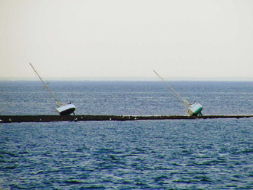 Then there was the time when at the end of a great day of sailing we were motoring up one of the beautiful tributaries of Then there was the time when at the end of a great day of sailing we were motoring up one of the beautiful tributaries of
For us that was once again an affirmation that not everyone out there has an open chart in the cockpit, an electronic gps chart plotter displaying position, course and speed, a radio tuned to the required hailing and distress frequency, and forget about a radar, or sometimes even a person on watch. So, what is the big deal? Is it really ego or are people just too cheap to buy charts? Or, God forbid, do they not know how to read a chart, and are thus not inclined to have one out? Whatever the reason, there is really no excuse. Paper charts may cost a few bucks, though less than a boat. But electronic charts, for those ‘in the know’ cost nothing for most
The bad news, however, is that NOAA’s budget has been cut for 2007 and the continued development of their free digital chart products is now at great risk. Now this is really a prime example of ‘bureaucraptic’ nonsense, particularly if you consider that the US Coast Guard is mandated by law to carry electronic charts by 2007 (note the coincidence). This is all the more relevant, since paper chart production is also being phased out by the government! So how about sliding some of the homeland security green over to NOAA! Doing so would encourage more boaters to use charts and thus potentially be safer. Safer boaters would mean less work for the Coasties, which would in turn save money… No, there is absolutely no reason for anyone, who knows what he or she is doing, and who respects and loves the sea for its beauty and its danger – even close to shore – not to implicitly obey both the First Rule of Boating and the First Rule of Seamanship. |
|
Europe: Port Aleria, Rosnakilly, Kilmeena, Westport, Co. Mayo, Ireland - USA: PO Box 726, Mahwah, NJ 07430 All content on this site is subject to Copyright© - All rights reserved. Contact us - Advertising - Privacy - Terms & Conditions - Copyright & Trademark - Webmaster |
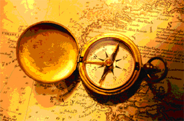 This makes so much sense that it almost seems trivial, or is it? A “first rule” implies that it is critical to comply with it for your own well being and for everyone else involved. Just like the first rule of living might be “Breathe”, and if you do not you will most assuredly die, so it is with boating. If you do not know where you are, and by correlation, where you are going, you are unlikely to know what dangers lie ahead, and are thus not only a danger to yourself and your shipmates, but also to everyone else out there.